|
Gardner & Peterson Associates, LLC has over 50
years of surveying experience within the State of Connecticut. We utilize state of the art surveying equipment and technology. Our
field staff is Occupational Safety and Health Administration (OSHA) certified and highly experienced.
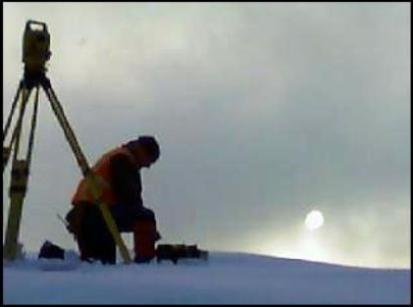
We provide the following accurate and timely surveys for homeowners,
developers, municipalities, and in support of our design team: - Property Boundary Surveys
- Improvement
Location Surveys
- Subdivision Design and Mapping
- Easement Maps
- Topographic Surveys
- Right-of-Way
Surveys
- Construction Stakeout
- Flood Certification Surveys
- ALTA / ASCM Surveys
Surveys defined by the Standards for Surveys and Maps
in the State of Connecticut: - Property
Survey: A survey which depicts or notes the position of boundaries with respect to:
- Locations of all boundary monumentation found or set;
- Apparent
improvements and features, including as a minimum: dwellings, barns, garages, sheds, driveways, roadways, surface utilities,
visible bodies of water and swimming pools;
- Record easements and visible
evidence of the use thereof;
- Record and apparent means of ingress and
egress;
- Lines of occupation, including as a minimum: fences, walls,
hedges and yards;
- Deed restrictions pertaining to the location of
buildings or other apparent improvements;
- Unresolved conflicts with
record deed descriptions and maps;
- All apparent boundary encroachments;
- Existing Building Location Survey: A survey which depicts or notes the position of all
buildings on the property with respect to boundaries, record easement lines and pertinent municipal setback requirements and
deed restrictions.
- Zoning
Location Survey: A survey which depicts or notes the position
of existing or proposed improvements with respect to applicable municipal setback requirements. The purpose of this type of
survey is to enable determination of compliance with said requirements.
Improvement
Location Survey: A survey which depicts or notes the position, horizontally and, where required, vertically,
between particular existing or proposed improvements with respect to the applicable municipal or statutory requirements. The
purpose of this type of survey is to enable determination of compliance with said requirements.
- Subdivision or Resubdivision Map: A map of a type of survey which depicts or notes the
layout of lots and the associated public or private highways, easements and lands and is intended for submission to applicable
regulatory entities.
Easement Map: A map of a type of survey
which depicts and notes the position of an existing or proposed easement with respect to: - Boundary
monumentation found or set;
- Improvements and features, including as
a minimum: dwellings, barns, garages, sheds, driveways, roadways, surface utilities, visible bodies of water, fences, walls,
hedges, yards and swimming pools;
- Other record easements and visible
evidence of the use thereof; and
- Unresolved conflicts with record
deed descriptions and maps
Topographic
Survey: A survey which depicts the configuration of the earth's surface (ground) and the location
of natural and artificial objects thereon.
Right of Way Survey: A
survey which maps the limits of existing or proposed highways or public utility transmission easements, including the mapping
of parcels to be acquired for such purpose(s), as referenced to an established baseline.
Gardner & Peterson
Associates, LLC also conducts surveys to provide amendments of Flood Insurance
Rate Maps for individual properties. |